Table of Contents
- What Is an Interactive Property Map?
- How Is It Different from a Google Maps Pin?
- Why Developers Use Interactive Property Maps to Sell Off-Plan
- What a Good Interactive Property Map Includes
- Interactive Property Map vs Static Listing Page
- Who Should Use an Interactive Property Map?
- How to Get an Interactive Property Map Built
- Frequently Asked Questions
What Is an Interactive Property Map?
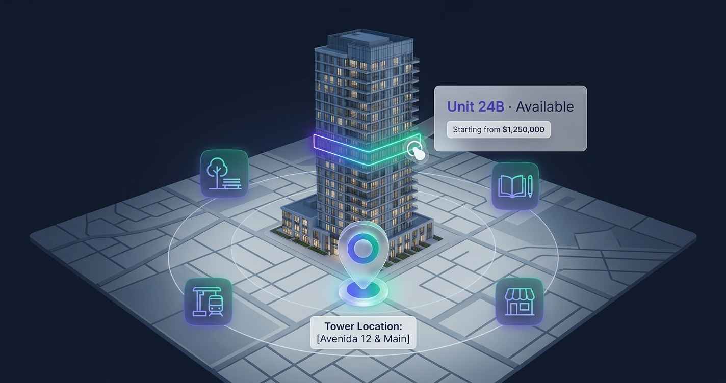
An interactive property map is a clickable version of your development’s own render — the building, the site plan, or the masterplan you already show buyers — where every unit and every point of interest responds to a tap. Instead of a flat image with a price list beside it, the buyer sees the project itself and interacts with it directly: hover a unit and it highlights, click it and a panel opens with the price, floor, area, view, gallery, and whether it is Available, Reserved, or Sold right now.
The key idea in an interactive property map is that the property is the interface. A buyer in Lagos or a diaspora investor browsing from London does not scroll a spreadsheet of listings — they explore the actual development, unit by unit, and see the amenities and points of interest around it in the same view. That is the difference between a page a buyer reads and a page a buyer plays with.
For developers, this is not a listing portal where your project competes with a thousand others. It is your project, on your own website, built to sell your units — and only your units.
Roughly 97% of home buyers use the internet during their property search. — National Association of Realtors, industry data
How Is It Different from a Google Maps Pin?
This is the most common mix-up, so it is worth being precise. A Google Maps pin drops a marker on a street address. It tells a buyer where your building sits in a city. It tells them nothing about the building itself — not which units are left, not the price on the 14th floor, not the view from the pool side.
An interactive property map flips that. The building and its units are the clickable thing, not a dot on a road network.
The Building Is Clickable, Not a Marker
On a plain map pin, you click a location. On an interactive property map, you click the units themselves inside a render of the tower, the site plan, or the masterplan. Each unit is a mapped, responsive shape overlaid on your own image — so the buyer is exploring your development, not a generic satellite view.
Live Availability, Not a Static Address
A map pin never changes. Your sales reality changes daily. An interactive property map shows real-time unit availability, so when a unit sells, the map reflects it — no stale PDF, no “let me check and call you back.” You can see how that works in detail in our guide to real-time unit availability for developers.
Amenities and Points of Interest, In Context
A good property map still does the thing people expect from a map: it shows points of interest — schools, malls, the beach, the highway, the metro — as context around the development. The difference is that those amenities sit alongside clickable, live units, so the buyer gets both “what is nearby” and “what can I actually buy” in one view.
Why Developers Use Interactive Property Maps to Sell Off-Plan
Selling off-plan means selling something the buyer cannot walk through. The render is the product. An interactive property map makes that render do the work a show unit would — especially for remote and diaspora buyers who will never visit the site before wiring a deposit.
It Converts Buyers Who Are Never in the Room
A buyer in Dubai looking at a project in Accra, or one in Toronto looking at Lagos, cannot pop into your sales office. The interactive property map is the sales office. They explore units, compare a pool-view apartment against a street-view one, check the price, and inquire in one tap — form submission plus WhatsApp or a direct call. The lead that lands with your team already names the unit, the floor, and the price the buyer was looking at.
It Answers the Repetitive Questions Automatically
Which units face the water? What is left on the top three floors? How big is the two-bedroom? Every one of those is a question your team answers by hand today. On an interactive property map, the buyer answers it themselves by filtering and clicking — and your team spends its time on qualified conversations instead. For more on this shift, see how real estate developers can increase pre-sales with technology.
It Builds Emotional Ownership
When a buyer spends a few minutes choosing between the 12th and 15th floor, scrolling a unit gallery, and picturing the view, they are already mentally moving in. A static listing grid cannot create that. Exploration creates attachment, and attachment closes off-plan sales.
What a Good Interactive Property Map Includes
Not every clickable image is a good interactive property map. The ones that actually convert share a specific feature set. Here is what to look for — or to ask for when you commission one.
Per-Unit Detail That the Developer Controls
Every unit should be able to reveal:
- Price (or “on request” — you choose which units show a number)
- Floor and unit type
- Area and view orientation
- Live status: Available, Reserved, or Sold
- Gallery and floor plan
Crucially, you decide what each unit reveals. Some developers show every price; others keep pricing on request for premium stock. The map should bend to your sales strategy, not the other way around.
One-Tap Inquiry Straight to Your Team
A buyer who is interested should never have to hunt for a contact page. From any unit, a single tap should open an inquiry — a form, plus WhatsApp and call options — so the moment of intent becomes a lead instantly.
Filters and Points of Interest
Buyers should be able to filter by bedrooms, price band, floor, or availability, and see amenities and points of interest mapped around the development. This is what separates a property map from a bare floor plan — it gives the buyer both the unit and the neighborhood.
Lightweight and Mobile-First
Most of these buyers are on a phone, often on a mobile network. A good interactive property map is fast-loading and lightweight — it is not a heavy 3D model that stalls on a mid-range Android. It should feel instant to tap and pan. (Related reading: interactive floor plans for real estate developers.)
Delivered as a Widget You Embed
You should not have to rebuild your website. A good map ships as an embeddable widget — a single script tag — that drops into WordPress, Webflow, or a custom site and is mapped to your own render.
Interactive Property Map vs Static Listing Page
| Feature | Static Listing Page | Google Maps Pin | Interactive Property Map |
|---|---|---|---|
| What’s clickable | Nothing (read-only) | A location marker | The units in your own render |
| Live availability | ❌ Outdated fast | ❌ None | ✅ Available / Reserved / Sold, live |
| Per-unit price & detail | ⚠️ Generic ranges | ❌ None | ✅ Price, floor, area, view, gallery |
| Points of interest / amenities | ⚠️ Listed as text | ✅ Yes, but no units | ✅ Amenities plus live units together |
| Inquiry | ⚠️ Generic contact form | ❌ None | ✅ One-tap form + WhatsApp/call, per unit |
| Lead quality | ❌ “I’m interested” | ❌ None | ✅ Names the exact unit, floor, price |
| Mobile experience | ⚠️ Scroll-heavy | ✅ Fine | ✅ Touch-optimized, lightweight |
| Works for remote buyers | ⚠️ Barely | ❌ No | ✅ Built for diaspora & off-plan |
The takeaway: a listing page describes your project and a map pin locates it, but only an interactive property map lets a remote buyer actually explore and choose a unit. If you want the foundational definition, our post on what an interactive tower map is covers the underlying concept.
Who Should Use an Interactive Property Map?
This is built for developers selling their own projects — not for agents building listing portals. It fits:
- Tower and condominium developers selling off-plan units before completion
- Estate, township, and land developers who need a clickable interactive site plan or masterplan rather than a single tower
- Developers selling to diaspora and remote buyers in Dubai, Lagos, and worldwide, who need the render to sell without a site visit
- Marketing teams who want qualified, unit-specific leads instead of “please send more info” emails
The qualifying question is simple: are you selling units in a development, and does your site currently show static images or PDFs? If yes, an interactive property map is the upgrade.
How to Get an Interactive Property Map Built
FoudaTech builds and runs Interactive Tower Maps and property maps as a done-for-you service. It is not a template you wrestle with alone — each map is custom-built and mapped to your own render, then hosted and maintained for you.
How the Model Works
You pay a one-time setup fee to build your map, plus an annual subscription that covers hosting and uptime, a live management dashboard, ongoing updates and support, and unlimited edits. Your team updates prices and toggles availability from the dashboard — no developer needed after delivery.
| Plan | Setup (one-time) | Annual Subscription |
|---|---|---|
| Starter | from $1,200 | $600 / year |
| Growth | $2,000 | $900 / year |
| Premium | from $5,000 | $2,000 / year |
All prices in USD. The right tier depends on the number of towers, units, and points of interest mapped.
What Delivery Looks Like
You send your render — tower elevation, site plan, or masterplan. FoudaTech maps every unit and point of interest with pixel-precise overlays, wires in your unit data, and delivers an embeddable widget you drop into your existing site with one script tag. Standard delivery is around two weeks; expedited delivery is available for larger or faster projects.
Explore Interactive Tower Maps → or contact us to scope your development.
Frequently Asked Questions
Is an interactive property map the same as a Google Maps embed?
No. A Google Maps embed drops a pin at your address. An interactive property map makes the units in your own render clickable — showing live availability, per-unit pricing, galleries, and one-tap inquiry — with amenities and points of interest mapped around them. It sells the units; a map pin only locates the building.
How much does an interactive property map cost?
Pricing is a one-time setup fee to build your map plus an annual subscription that covers hosting, the management dashboard, updates, and unlimited edits. Plans start from $1,200 setup plus $600 per year (USD). The exact figure depends on the number of towers, units, and points of interest. Contact us for a scoped estimate.
Can buyers see which units are still available?
Yes. Every unit carries a live status — Available, Reserved, or Sold — that your team updates from the dashboard. Buyers always see the current sales reality, not a stale PDF.
Will it slow down my website?
No. The map is built lightweight and fast-loading, optimized to open quickly on mobile networks. It is not a heavy 3D model, so it stays responsive even for remote buyers on mid-range phones.
Do I need to rebuild my website to add it?
No. It ships as an embeddable widget — a single script tag that drops into WordPress, Webflow, or a custom site. No migration, no redesign.
How long does it take to build?
Standard delivery is around two weeks from receiving your render to handing over the embeddable widget. Larger multi-tower or masterplan projects take a little longer, and expedited delivery is available for an additional fee.