Table of Contents
- What Is an Interactive Site Plan?
- Static PDF Site Plan vs Interactive Site Plan
- How an Interactive Site Plan Works
- Why Off-Plan Developers Adopt Interactive Site Maps
- What a Good Interactive Site Plan Includes
- Site Plan vs Tower Map: Which Do You Need?
- How to Get an Interactive Site Plan
- Frequently Asked Questions
What Is an Interactive Site Plan?
An interactive site plan is the master map of your development turned into a clickable, live sales tool. Instead of a flat PDF where every plot looks the same, each plot or unit becomes a clickable overlay on your existing render — buyers tap a plot and instantly see its price, size, orientation, and whether it is Available, Reserved, or Sold.
If you are selling a gated community, a townhouse scheme, a mixed-use masterplan, or a land subdivision, the site plan is the first thing a serious buyer looks at. They want to know which plot, where it sits, what it costs, and whether it is still on the market. A static image answers none of those questions. An interactive site plan answers all four before your sales team picks up the phone.
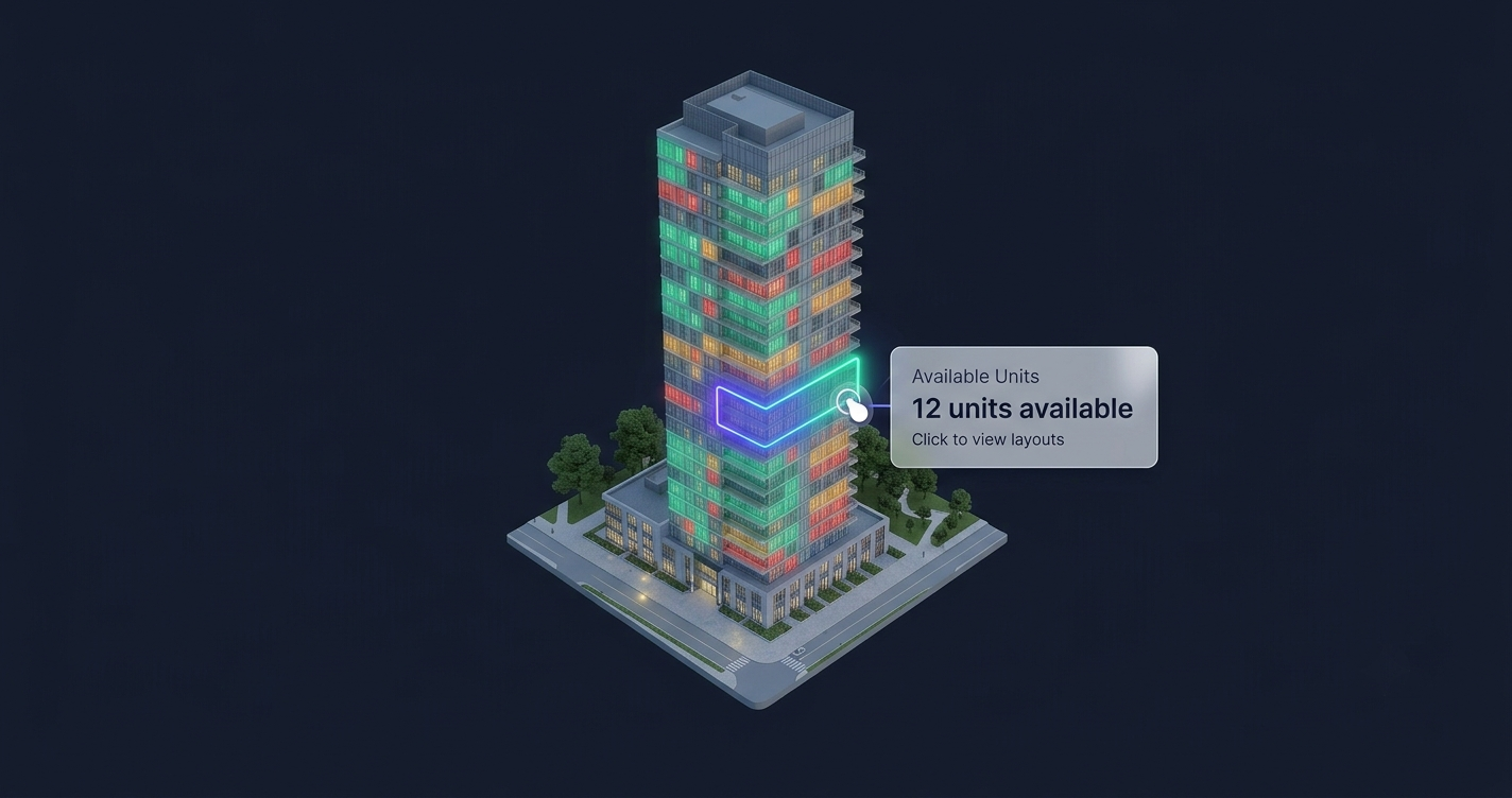
Think of it as the development-wide cousin of an interactive tower map. A tower map handles a single building floor by floor; an interactive site map handles the whole estate — every plot, block, villa, and phase — on one zoomable canvas. Same idea, wider scope.
The shift matters because buying behaviour has already moved online. Industry surveys suggest around 8 in 10 buyers are more likely to engage a listing that includes a clear floor plan or site layout they can actually explore. When your competitor lets a diaspora buyer in London reserve Plot 42 from their phone and you make them email for a price list, you have already lost the momentum.
Static PDF Site Plan vs Interactive Site Plan
The old workflow is the same everywhere: a buyer downloads a PDF, zooms into a pixelated grid of plots, guesses which ones are available, then emails or calls to ask “how much is Plot 12, and is it still free?” Every one of those questions is friction — and friction is where deals go cold.
| Static PDF Site Plan | Interactive Site Plan | |
|---|---|---|
| Plot pricing | ”Contact for price” | Per-plot price shown on tap (or “on request” by choice) |
| Availability | Outdated the day it is exported | Live status — Available / Reserved / Sold |
| Buyer questions | Every plot needs a phone call | Answered instantly, on-page |
| Filtering | None — scroll and squint | Filter by size, type, price, phase, availability |
| Mobile | Unreadable, pinch-and-zoom | Touch-optimised, loads fast even on mobile |
| Updates | Re-export and re-upload the whole file | Update one plot in the dashboard |
| Lead quality | ”I’m interested in the project" | "I want Plot 42, 3-bed, garden-facing” |
A static site plan made sense when brochures were printed. In 2026 it is a conversion bottleneck. The interactive version does not just look better — it removes the wait between a buyer’s interest and their ability to act on it.
How an Interactive Site Plan Works
An interactive site plan is not a heavy 3D model or a game engine that takes forever to load. It is a lightweight overlay built on top of the render you already own. Three layers make it work.
The image layer
Your existing masterplan render — aerial view, isometric, or drone photo — is the base. You do not commission new artwork. Whatever you already show in your brochure becomes the canvas.
The overlay layer
Every plot, villa, or block is mapped as a clickable shape traced precisely onto your render. These overlays scale cleanly from a desktop monitor down to a phone, so a plot boundary stays pixel-accurate at any size. This is the same custom mapping approach behind our interactive masterplan builds.
The data layer
Each overlay connects to a plot’s live data:
- Price (shown, or “on request” — your call per plot)
- Plot / unit number, phase, and block
- Size, type, and orientation (garden, corner, waterfront)
- Status — Available, Reserved, Sold, updated live from your dashboard
- Gallery and floor plan for the unit type
- One-tap inquiry — form plus WhatsApp or call
Buyers filter the whole development — show me only available 4-bed villas under $400,000 in Phase 2 — and inquire in a single tap. You control exactly what each plot reveals, right down to hiding price where you prefer discretion. Because it is a site plan software layer and not a rebuilt render, it stays fast to load even on mobile networks.
See a live interactive tower map → or request a free preview.
Why Off-Plan Developers Adopt Interactive Site Maps
Off-plan is where an interactive site map earns its keep. You are selling something that does not physically exist yet, to buyers who are often in another city or country. The site plan is the product until construction catches up.
It sells to remote and diaspora buyers
A buyer in Dubai looking at a scheme in Lagos, or a Nigerian professional in Toronto buying back home, cannot walk the site. An interactive site plan lets them explore every plot, compare orientations, and reserve without a single site visit. Plot/unit availability updates live, so they trust that what they see is real.
It creates urgency honestly
When a buyer sees three plots in their preferred row already marked Sold and only two left Available, scarcity does the selling for you — without anyone having to exaggerate. Live status is far more persuasive than a salesperson claiming “they’re going fast.”
It generates better leads
Proptech studies report interactive maps can generate 2–3× more leads and hold buyers on the page 3+ minutes, versus seconds for a static image. More importantly, the lead arrives qualified: your team knows the exact plot, size, and budget before the conversation starts. That is the same pre-sales lever we cover in how developers increase pre-sales with technology.
What a Good Interactive Site Plan Includes
Not every “clickable map” is worth having. A site plan that actually moves deals has these traits:
- Live availability wired to a dashboard your sales team controls — not a status you email a developer to change.
- Per-plot data rich enough to answer the real question (price, size, view, floor plan), with the option to hide price where you want.
- Real filtering, so a buyer narrows 200 plots to the 4 that fit them in seconds.
- One-tap inquiry via form, WhatsApp, or call — captured against the specific plot.
- Lightweight delivery — an embeddable widget, not a heavy 3D build, so it loads fast on any phone.
- Unlimited edits, because prices move, phases release, and plots sell — the tool has to keep up without a redesign.
The same standards apply to a single building — see our breakdown of interactive floor plans for developers and how real-time unit availability changes buyer trust.
Site Plan vs Tower Map: Which Do You Need?
They solve the same problem at different scales. Many developments use both.
| Interactive Site Plan | Interactive Tower Map | |
|---|---|---|
| Best for | Estates, townhouses, land plots, masterplans | A single multi-storey building |
| Maps | Plots, villas, blocks, phases | Floors and units within one tower |
| View | Aerial / masterplan render | Building elevation render |
| Typical buyer question | ”Which plot, and is it free?" | "Which floor and unit, and the view?” |
| Also see | Interactive masterplan | Interactive building visualizer |
If your development is horizontal — spread across land — you want an interactive site plan. If it is vertical, you want a tower map. A mixed scheme with towers and villas can use both: a site plan for the villa plots, plus a dedicated interactive map for each tower, tied together with a building selector. The difference between the two is worth understanding fully, which we cover in interactive tower map vs floor plan.
How to Get an Interactive Site Plan
FoudaTech builds interactive site plans as a done-for-you service, custom-mapped to your own render. You do not configure a generic template alone, and you do not rebuild your website.
The process
- Send your masterplan render — the aerial or isometric image you already use.
- We map every plot as a precise clickable overlay, matched to your brand.
- You provide plot data — pricing, sizes, types, galleries, floor plans.
- We build the map plus a live dashboard your team controls.
- We deliver an embeddable widget — one script tag that drops into WordPress, Webflow, or any custom site.
Standard delivery is around two weeks, with expedited timelines available for larger schemes.
What it costs
Pricing is a one-time setup fee plus an annual subscription (USD). The subscription covers hosting and uptime, your live management dashboard, updates and support, and unlimited edits — so as plots sell and prices move, the map stays current.
- Starter — from $1,200 setup + $600/year
- Growth — $2,000 setup + $900/year
- Premium — from $5,000 setup + $2,000/year
You are not buying a one-off file; you are running a live sales tool that is maintained for you. When a plot sells, your team flips it to Sold in the dashboard and every buyer sees it instantly.
See a live interactive tower map → or request a free preview.
Frequently Asked Questions
What is the difference between a site plan and a masterplan?
In practice they overlap. A masterplan is the overall design of a development — how plots, roads, and amenities are laid out. A site plan is the map buyers use to pick a specific plot. An interactive site plan makes that map clickable, with live pricing and availability on every plot.
Can I hide prices on some plots?
Yes. You decide, per plot, whether to show a price, display “on request,” or hide pricing entirely. Buyers still see the plot’s status, size, and details, and can inquire in one tap — you control exactly what is revealed.
Do I need to rebuild my website?
No. The interactive site plan is delivered as an embeddable widget — a single script tag that drops into WordPress, Webflow, or any custom site. It sits alongside your existing content with no rebuild or migration.
How does availability stay up to date?
Your sales team updates it from a live dashboard. Flip a plot to Available, Reserved, or Sold and every buyer sees the change immediately. Keeping availability current is part of the annual subscription, along with unlimited edits.
Will it slow down my site?
No. It is a lightweight overlay on your existing render, not a heavy 3D model — it loads fast even on mobile. Galleries and images are optimised so the map stays responsive on emerging-market networks.
How long does it take to build?
Standard delivery is around two weeks from receiving your render and plot data. Larger multi-phase developments take a little longer, and expedited delivery is available if you have a launch date to hit.